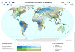
High Detail Current & Future Global Groundwater Map
During the past decades the interest in groundwater increased considerably due to water shortage problems on local, regional and even global levels. The use of groundwater is considered as an appropriate way out of regional water crises caused by population growth and economic development but the knowledge of this hidden resource is still weak in many places and investments in groundwater management and protection are insufficient.
In order to contribute to the world-wide efforts to better study, manage and protect freshwater resources the World-wide Hydrogeological Mapping and Assessment Programme (WHYMAP) was launched in 1999.
The program aims at collecting, collating and visualizing hydro-geological information at a global scale. Maps are convenient tools to convey groundwater related information in an appropriate way to groundwater experts as well as to non-experts or politicians. WHYMAP thus brings together the huge efforts in hydro-geological mapping, at regional, national and continental levels.

Leave a Reply